ICESat/GLAS
Overview
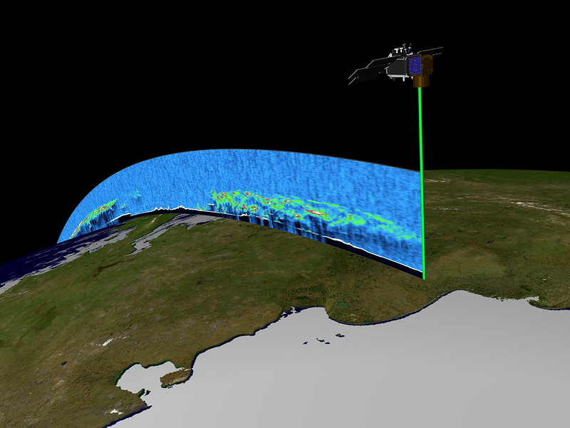
The NSIDC DAAC ICESat/GLAS collection includes data products derived from the Geoscience Laser Altimeter System (GLAS) instrument that flew on NASA's Ice, Cloud, and land Elevation Satellite (ICESat) from 2003 to early 2010. By combining surface lidar with cloud and aerosol lidar, GLAS precisely measured surface heights of ice masses, and heights within Earth’s atmosphere. Data products at the NSIDC DAAC describe elevations of ice sheets, glaciers, and sea ice, as well as height profiles of clouds and aerosols.
The ICESat/GLAS mission's primary goal was to measure ice sheet mass balance: the difference between an ice sheet's snow input, and the ice loss through melting, ablation, or calving. The elevation of an ice sheet or glacier is a strong indicator of whether the ice body is gaining or losing mass, and ice mass loss has significant implications for global sea level. The mission was also designed to measure atmospheric parameters, improving understanding of how atmospheric changes affect polar ice masses and sea level.
Initially planned to last three years, NASA’s ICESat/GLAS mission remained operational for seven. The ICESat satellite launched on January 12, 2003, and operated until February 2010. GLAS collected observations along specific observational ground tracks, repeating observations every 180 days.
ICESat/GLAS was the first in a series of planned missions to measure changes in ice sheet elevation, and heights of clouds and aerosols. Subsequent missions examining elevations of glaciers and ice sheets include Operation IceBridge and ICESat-2. The NSIDC DAAC provides data from those missions, as well as from the Program for Arctic Regional Climate Assessment (PARCA), which focuses on studies of the Greenland Ice Sheet.
The NSIDC DAAC ICESat/GLAS collection includes Level-1 and Level-2 data products, which range in temporal coverage from February 2003 to October 2009.
Parameters
Glacier and ice sheet elevation, glacier and ice sheet topography, sea ice elevation, sea ice thickness, ice roughness, sea surface height, terrain elevation, aerosol backscatter, cloud reflectance, calibration data
Geographic coverage
Global
Related collection(s)
Explore images from ICESat/GLAS